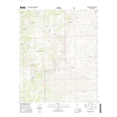
2017 Map of Sugarloaf Peak
USGS Topo · Published 2017About this map
The settlement of Hermosa anchors the southwestern portion of this landscape, situated near the confluence of Morgan Cr and the S Fork Palomas Cr. This area of the Gila National Forest is defined by a dense network of canyons and peaks, including the prominent Sugarloaf Peak and Black Peak. The terrain is marked by numerous seasonal water sources and drainage systems, such as Moccasin John Canyon to the north and Wagonbed Canyon near the center. Historically, the presence of the Hermosa Cem near the townsite indicates a long-standing human connection to this high-desert environment. The map details the complex topography of the Black Range, where springs like Flag Spring and Enrick Spring provided essential water in a landscape carved by the N Fork Palomas Cr and Salado Cr.
Find a feature on this map
54 named features on this map. Tap any name to fly to it.
Don’t see what you’re looking for? This feature index may not catch every label — zoom into the map to look around manually.
Map Details
Editions of this 2017 Sugarloaf Peak Map
This is the sole edition of this map. No revisions or reprints were ever made.
Other maps of this area

1949 · Lookout Mountain
USGS Topo · 1:62,500

1954 · Tularosa
USGS Topo · 1:250,000

1958 · Tularosa
USGS Topo · 1:250,000

1963 · Bell Mountain
USGS Topo · 1:24,000

1963 · Thumb Tank Peak
USGS Topo · 1:24,000

1963 · Reeds Peak
USGS Topo · 1:24,000

1963 · Sugarloaf Peak
USGS Topo · 1:24,000

1963 · Victoria Park
USGS Topo · 1:24,000

1963 · Apache Peak
USGS Topo · 1:24,000

1965 · Winston
USGS Topo · 1:24,000