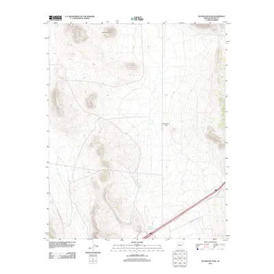
2011 Map of Sugarloaf Peak
USGS Topo · Published 2011About this map
Sugarloaf Peak rises above the open expanse of Seventyfour Plains in this 2011 survey of Yavapai County. The landscape is defined by its ranching infrastructure, where water sources like Gabriel Tank, Celedonio Tank, and Number Five Trough are critical landmarks across the arid terrain. These features reflect the long-standing livestock operations that have shaped this portion of Arizona for generations.
Find a feature on this map
17 named features on this map. Tap any name to fly to it.
Don’t see what you’re looking for? This feature index may not catch every label — zoom into the map to look around manually.
Map Details
Editions of this 2011 Sugarloaf Peak Map
This is the sole edition of this map. No revisions or reprints were ever made.
Other maps of this area

1886 · Diamond Creek
USGS Topo · 1:250,000

1892 · Diamond Creek
USGS Topo · 1:250,000

1948 · Williams
USGS Topo · 1:250,000

1954 · Williams
USGS Topo · 1:250,000

1956 · Williams
USGS Topo · 1:250,000

1960 · Williams
USGS Topo · 1:250,000

1961 · Williams
USGS Topo · 1:250,000
1980 · Fort Rock Ranch
USGS Topo · 1:24,000
1980 · Cross Mountain
USGS Topo · 1:24,000
1980 · Squaw Peak
USGS Topo · 1:24,000