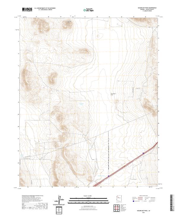
2021 Map of Sugarloaf Peak
USGS Topo · Published 2021About this map
Sugarloaf Peak dominates the high ground in this section of Arizona's western highlands, marking a landscape defined by expansive plateaus and intermittent water sources. The area showcases a pattern of rangeland management typical of the modern era, where vital water catchments like Celedonio Tank and Gabriel Tank support life across the Seventyfour Plains. The topography is etched by the Markham Wash, while the elevated spine of Wrangler Ridge offers a natural barrier to the east. A network of ranch and access roads, including Harris Branch Rd and Pinon Ranch Rd, reveals how this remote terrain is navigated and utilized. This modern survey by the U.S. Geological Survey captures the quiet infrastructure of the contemporary West, tracing the subtle relationship between high-desert terrain and the long-established ranching routes that cross it.
Find a feature on this map
16 named features on this map. Tap any name to fly to it.
Don’t see what you’re looking for? This feature index may not catch every label — zoom into the map to look around manually.
Map Details
Editions of this 2021 Sugarloaf Peak Map
This is the sole edition of this map. No revisions or reprints were ever made.
Other maps of this area

1886 · Diamond Creek
USGS Topo · 1:250,000

1892 · Diamond Creek
USGS Topo · 1:250,000

1948 · Williams
USGS Topo · 1:250,000

1954 · Williams
USGS Topo · 1:250,000

1956 · Williams
USGS Topo · 1:250,000

1960 · Williams
USGS Topo · 1:250,000

1961 · Williams
USGS Topo · 1:250,000
1980 · Fort Rock Ranch
USGS Topo · 1:24,000
1980 · Cross Mountain
USGS Topo · 1:24,000
1980 · Squaw Peak
USGS Topo · 1:24,000