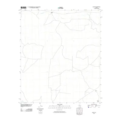
2010 Map of Suggs
USGS Topo · Published 2010About this map
Spring Creek meanders through this portion of the Edwards Plateau, defining the drainage patterns of a landscape characterized by ranching and rural transit. Near the northern border, the settlement of Suggs sits along Co RD 131, serving as a focal point for the surrounding rangeland. The map detail reflects the sparse, high-plains geography of Irion County, where large landholdings like the De Long Ranch dominate the southern reach. The network of unimproved roads and survey lines illustrates the methodical division of Texas ranch country, where water sources like the creek remain the primary driver for settlement and land use.
Find a feature on this map
5 named features on this map. Tap any name to fly to it.
Don’t see what you’re looking for? This feature index may not catch every label — zoom into the map to look around manually.
Map Details
Editions of this 2010 Suggs Map
This is the sole edition of this map. No revisions or reprints were ever made.
Other maps of this area

1895 · Sherwood
USGS Topo · 1:125,000

1920 · Barnhart
USGS Topo · 1:62,500

1922 · Barnhart
USGS Topo · 1:62,500

1954 · Sonora
USGS Topo · 1:250,000

1954 · San Angelo
USGS Topo · 1:250,000

1958 · Sonora
USGS Topo · 1:250,000

1958 · San Angelo
USGS Topo · 1:250,000

1964 · Oglesby Ranch
USGS Topo · 1:24,000

1965 · San Angelo
USGS Topo · 1:250,000

1967 · Double Mill Draw NW
USGS Topo · 1:24,000