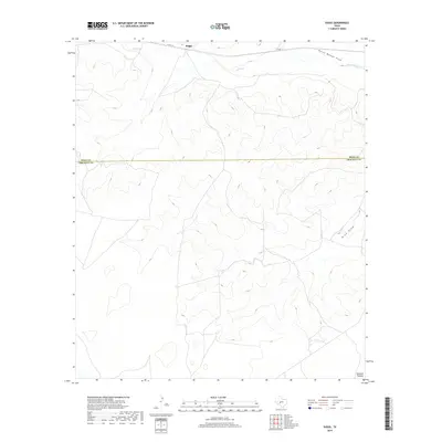
2019 Map of Suggs
USGS Topo · Published 2019About this map
Suggs sits along the northern edge of this West Texas survey, where the rolling breaks of the Edwards Plateau begin their descent toward the drainage basins of the Concho River valley. The landscape is defined by the ephemeral watercourses of Spring Cr and the descriptively named Dutch Woman Draw, which cut through the high plains. Historically, this area represents the transition between the ranching heartland of Irion County and the open range of Crockett County to the south. The primary artery for the sparse settlement is Co RD 131, which skirts the northern boundary near the headwaters of Nine Draw. This topographic study highlights the isolated character of the plateau, capturing the natural drainage patterns and high-elevation relief that shaped the early cattle-driving and sheep-raising economies of the region.
Find a feature on this map
7 named features on this map. Tap any name to fly to it.
Don’t see what you’re looking for? This feature index may not catch every label — zoom into the map to look around manually.
Map Details
Editions of this 2019 Suggs Map
This is the sole edition of this map. No revisions or reprints were ever made.
Other maps of this area

1895 · Sherwood
USGS Topo · 1:125,000

1920 · Barnhart
USGS Topo · 1:62,500

1922 · Barnhart
USGS Topo · 1:62,500

1954 · Sonora
USGS Topo · 1:250,000

1954 · San Angelo
USGS Topo · 1:250,000

1958 · Sonora
USGS Topo · 1:250,000

1958 · San Angelo
USGS Topo · 1:250,000

1964 · Oglesby Ranch
USGS Topo · 1:24,000

1965 · San Angelo
USGS Topo · 1:250,000

1967 · Double Mill Draw NW
USGS Topo · 1:24,000