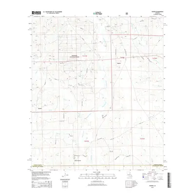
2015 Map of Sugrue
USGS Topo · Published 2015About this map
Kisatchie National Forest land dominates the northern half of this landscape, where the settlements of Cravens and Sugrue lie along the transition between wooded uplands and the drainage basins of the south. The terrain is deeply defined by the winding course of Whisky Chitto Cr, which is fed by numerous named tributaries including Drakes Cr and Sugar Cr. For the family historian, the map preserves the locations of several burial grounds such as Grave Hill Cem, Wisby Cem, and Pine Grove Cem, alongside small rural communities like Cole Central and Markee. A dense network of local roads, including Troy Weldon Rd and Gravel Hill Church Rd, reveals the pattern of 21st-century timber land management and rural residency across the Vernon Parish and Beauregard Parish line.
Find a feature on this map
61 named features on this map. Tap any name to fly to it.
Don’t see what you’re looking for? This feature index may not catch every label — zoom into the map to look around manually.
Map Details
Editions of this 2015 Sugrue Map
This is the sole edition of this map. No revisions or reprints were ever made.
Other maps of this area

1941 · Slagle
USGS Topo · 1:62,500

1943 · Leander
USGS Topo · 1:62,500

1944 · Slagle
USGS Topo · 1:62,500

1947 · Ikes
USGS Topo · 1:31,680

1947 · Chasmore
USGS Topo · 1:31,680

1947 · Grant
USGS Topo · 1:31,680

1947 · Sugartown
USGS Topo · 1:31,680

1947 · Sugrue
USGS Topo · 1:31,680

1947 · Pitkin
USGS Topo · 1:31,680

1948 · Grant
USGS Topo · 1:24,000