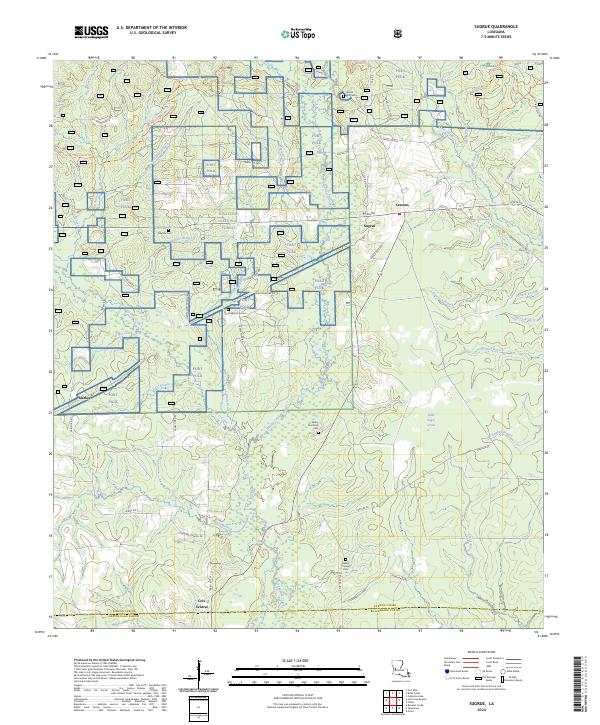
2024 Map of Sugrue
USGS Topo · Published 2024About this map
Kisatchie National Forest dominates the landscape of this Louisiana interior, where the managed timberlands of the southeast meet the sprawling military reservation of Fort Polk. The settlement pattern reflects the area's timber and rail history, centered on the crossroads at Cravens and the namesake Sugrue. Local genealogy is anchored by several distinct burial grounds, including the Gravel Hill Cem near the northern boundary and the Talbert Pierson Cem to the south. The drainage of Whisky Chitto Creek and its many tributaries, such as Drakes Creek and Marlow Branch, suggests a landscape of dense bottoms and pine-covered ridges. Evidence of earlier industry is preserved in the Old Railroad Gr, which cuts across the central forest, tracing a path through the modern military training grounds and forestry parcels that define this portion of Vernon Parish.
Find a feature on this map
67 named features on this map. Tap any name to fly to it.
Don’t see what you’re looking for? This feature index may not catch every label — zoom into the map to look around manually.
Map Details
Editions of this 2024 Sugrue Map
This is the sole edition of this map. No revisions or reprints were ever made.
Other maps of this area

1941 · Slagle
USGS Topo · 1:62,500

1943 · Leander
USGS Topo · 1:62,500

1944 · Slagle
USGS Topo · 1:62,500

1947 · Ikes
USGS Topo · 1:31,680

1947 · Chasmore
USGS Topo · 1:31,680

1947 · Grant
USGS Topo · 1:31,680

1947 · Sugartown
USGS Topo · 1:31,680

1947 · Sugrue
USGS Topo · 1:31,680

1947 · Pitkin
USGS Topo · 1:31,680

1948 · Grant
USGS Topo · 1:24,000