
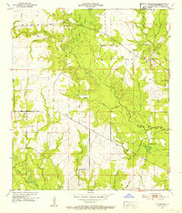
1947 Map of Sugrue
USGS Topo · Published 1947About this map
Kisatchie National Forest dominates the landscape of this 1947 survey, where a complex network of watercourses like Whisky Chitto Creek and Drakes Creek define the central Louisiana terrain. The map captures a period of industrial transition, showing the Gulf Colorado and Santa Fe Railroad alongside an extensive Old Logging Railroad system, indicating the area's history in timber and transport. Smaller settlements such as Sugrue, Cravens, and Markee are documented alongside community cornerstones like Gravel Hill Ch, Gravel Hill Sch, and Drakes Fork Ch. On the southern edge of the sheet, the boundary between Vernon Parish and Beauregard Parish is clearly delineated near Cole Center, providing essential data for genealogists tracing family locations across parish lines in the mid-20th century.
Find a feature on this map
34 named features on this map. Tap any name to fly to it.
Don’t see what you’re looking for? This feature index may not catch every label — zoom into the map to look around manually.
Map Details
Editions of this 1947 Sugrue Map
This is the sole edition of this map. No revisions or reprints were ever made.
Other maps of this area

1941 · Slagle
USGS Topo · 1:62,500

1943 · Leander
USGS Topo · 1:62,500

1944 · Slagle
USGS Topo · 1:62,500

1947 · Ikes
USGS Topo · 1:31,680

1947 · Chasmore
USGS Topo · 1:31,680

1947 · Grant
USGS Topo · 1:31,680

1947 · Sugartown
USGS Topo · 1:31,680

1947 · Pitkin
USGS Topo · 1:31,680

1948 · Grant
USGS Topo · 1:24,000
1951 · Sugartown
USGS Topo · 1:24,000