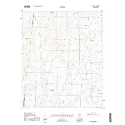
2018 Map of Sulligent SW
USGS Topo · Published 2018About this map
Vernon and southern Sulligent anchor this landscape along the Mississippi-Alabama state line in Lamar County. The terrain is defined by a dense network of tributaries including Watson Creek, Indian Creek, and Moors Creek, which feed into larger bodies like Sulligent Lake and County Lake. The settlement pattern is largely rural, connected by a web of local roads such as Military Grove Road and Shake Rag Road. Numerous country burial grounds like Corinth Cemetery, New Hope Cemetery, and Rising Star Cemetery are scattered throughout the hills, providing valuable markers for genealogical research. The presence of Holley Crossing and the intersection of various county roads suggest long-established transit corridors between these Alabama communities and neighboring Monroe County in Mississippi.
Find a feature on this map
105 named features on this map. Tap any name to fly to it.
Don’t see what you’re looking for? This feature index may not catch every label — zoom into the map to look around manually.
Map Details
Editions of this 2018 Sulligent SW Map
This is the sole edition of this map. No revisions or reprints were ever made.
Other maps of this area

1953 · West Point
USGS Topo · 1:250,000

1958 · West Point
USGS Topo · 1:250,000

1960 · Caledonia
USGS Topo · 1:62,500

1963 · West Point
USGS Topo · 1:250,000

1966 · Greenwood Springs
USGS Topo · 1:24,000

1966 · Amory SE
USGS Topo · 1:24,000

1967 · Sulligent
USGS Topo · 1:24,000

1967 · Beaverton
USGS Topo · 1:24,000

1967 · Hightogy
USGS Topo · 1:24,000

1967 · Sulligent SW
USGS Topo · 1:24,000