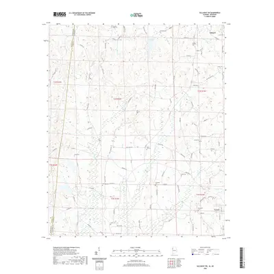
2020 Map of Sulligent SW
USGS Topo · Published 2020About this map
The Vernon and Sulligent area of Lamar County, Alabama, is defined by a dense network of family-named roads and rural burial grounds near the Mississippi state line. Numerous cemeteries, such as Pleasant Ridge Cem and Rising Star Cem, are scattered among the ridges and hollows, serving as vital landmarks for genealogists and local historians. The landscape is deeply carved by watercourses like Watson Cr and Indian Cr, which feed into Sulligent Lake and Faulkner Lake. Transportation is dominated by rural routes like Gattman Rd and Shake Rag Rd, illustrating the persistent settlement patterns of this corner of the state. The presence of Shiloh Cem and Corinth Cem further emphasizes the long-standing community centers established throughout the township and range divisions.
Find a feature on this map
102 named features on this map. Tap any name to fly to it.
Don’t see what you’re looking for? This feature index may not catch every label — zoom into the map to look around manually.
Map Details
Editions of this 2020 Sulligent SW Map
This is the sole edition of this map. No revisions or reprints were ever made.
Other maps of this area

1953 · West Point
USGS Topo · 1:250,000

1958 · West Point
USGS Topo · 1:250,000

1960 · Caledonia
USGS Topo · 1:62,500

1963 · West Point
USGS Topo · 1:250,000

1966 · Greenwood Springs
USGS Topo · 1:24,000

1966 · Amory SE
USGS Topo · 1:24,000

1967 · Sulligent
USGS Topo · 1:24,000

1967 · Beaverton
USGS Topo · 1:24,000

1967 · Hightogy
USGS Topo · 1:24,000

1967 · Sulligent SW
USGS Topo · 1:24,000