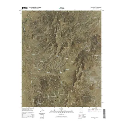
2014 Map of Sullivan Buttes
USGS Topo · Published 2014About this map
Sullivan Buttes dominates the central landscape of this Yavapai County region, situated between the expanding residential areas of Williamson and Paulden. In this 2014 survey, the high desert terrain is defined by an intricate network of intermittent watercourses, including Williamson Valley Wash, Mint Wash, and Dillon Wash. These drainages are supported by numerous livestock tanks and small catchments such as Miller Dam Tank and Section Two Dam Tank, which are vital for the local ranching economy. The settlement pattern shows a distinct mix of established town centers like Chino Valley and newer rural developments accessible by a dense grid of local roads, such as N Williamson Valley Rd and W Rambling RD. Aviation infrastructure is also noted with the presence of the H&H Ranch Airstrip, highlighting the area's spread-out, rural character.
Find a feature on this map
91 named features on this map. Tap any name to fly to it.
Don’t see what you’re looking for? This feature index may not catch every label — zoom into the map to look around manually.
Map Details
Editions of this 2014 Sullivan Buttes Map
This is the sole edition of this map. No revisions or reprints were ever made.
Other maps of this area

1887 · Prescott
USGS Topo · 1:250,000

1892 · Prescott
USGS Topo · 1:250,000

1905 · Jerome
USGS Topo · 1:125,000

1947 · Simmons
USGS Topo · 1:62,500

1947 · Iron Springs
USGS Topo · 1:62,500

1947 · Paulden
USGS Topo · 1:62,500

1947 · Prescott
USGS Topo · 1:62,500

1948 · Iron Springs
USGS Topo · 1:63,360

1948 · Prescott
USGS Topo · 1:62,500

1948 · Simmons
USGS Topo · 1:63,360