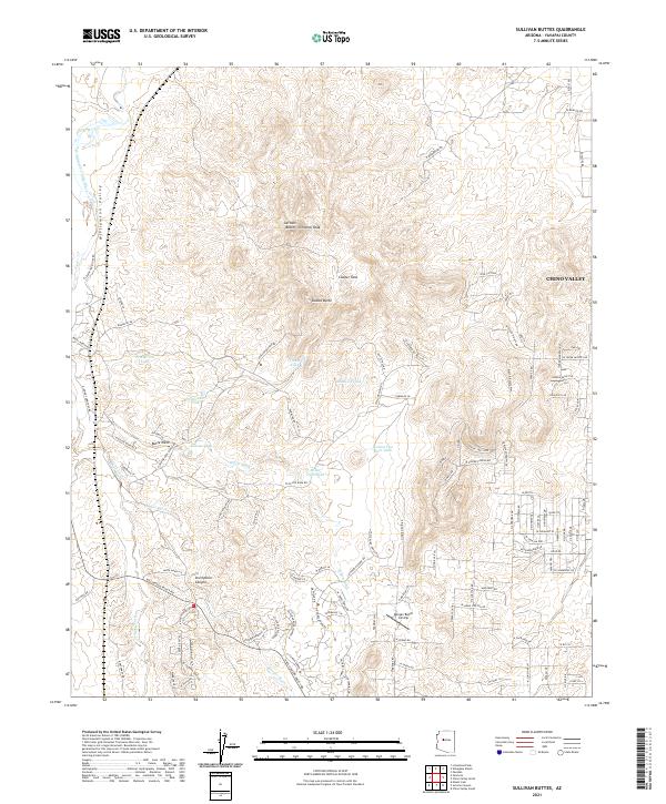
2021 Map of Sullivan Buttes
USGS Topo · Published 2021About this map
Sullivan Buttes and Simmons Peak dominate the high-elevation landscape of this region, which transitions from the rugged terrain of Williamson Valley in the west to the developing outskirts of Chino Valley in the east. The map records a complex network of private ranches and water infrastructure, evidenced by the numerous catchment points such as Miller Dam Tank, Pemberton Tank, and Scissor Tank. These features suggest a landscape deeply tied to livestock management and water conservation in an arid environment.
Find a feature on this map
113 named features on this map. Tap any name to fly to it.
Don’t see what you’re looking for? This feature index may not catch every label — zoom into the map to look around manually.
Map Details
Editions of this 2021 Sullivan Buttes Map
This is the sole edition of this map. No revisions or reprints were ever made.
Other maps of this area

1887 · Prescott
USGS Topo · 1:250,000

1892 · Prescott
USGS Topo · 1:250,000

1905 · Jerome
USGS Topo · 1:125,000

1947 · Simmons
USGS Topo · 1:62,500

1947 · Iron Springs
USGS Topo · 1:62,500

1947 · Paulden
USGS Topo · 1:62,500

1947 · Prescott
USGS Topo · 1:62,500

1948 · Iron Springs
USGS Topo · 1:63,360

1948 · Prescott
USGS Topo · 1:62,500

1948 · Simmons
USGS Topo · 1:63,360