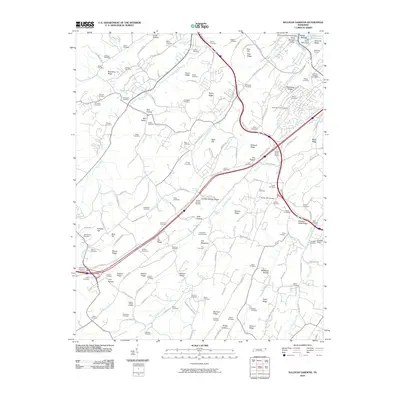
2010 Map of Sullivan Gardens
USGS Topo · Published 2010About this map
Fort Patrick Henry Lake and the Fort Henry Dam anchor the northeast corner of this 2010 Sullivan County landscape, where the waters of Kendrick Creek and Horse Creek flow through a terrain defined by parallel ridges. The map reveals a dense network of family history markers, particularly evident in the high concentration of small burial grounds like Logans Chapel Cemetery, Kincheloe-Cox Cemetery, and Hickman Cemetery. These sites are often found along the base of prominent features such as Horse Ridge and Easley Ridge, tracing the settlement patterns of earlier generations.
Find a feature on this map
143 named features on this map. Tap any name to fly to it.
Don’t see what you’re looking for? This feature index may not catch every label — zoom into the map to look around manually.
Map Details
Editions of this 2010 Sullivan Gardens Map
This is the sole edition of this map. No revisions or reprints were ever made.
Other maps of this area

1891 · Roan Mountain
USGS Topo · 1:125,000

1892 · Greeneville
USGS Topo · 1:125,000

1894 · Roan Mountain
USGS Topo · 1:125,000

1894 · Estillville
USGS Topo · 1:125,000

1896 · Greeneville
USGS Topo · 1:125,000

1897 · Bristol
USGS Topo · 1:125,000

1902 · Bristol
USGS Topo · 1:125,000

1904 · Roan Mountain
USGS Topo · 1:125,000

1904 · Greeneville
USGS Topo · 1:125,000

1935 · Lovelace
USGS Topo · 1:24,000