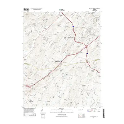
2016 Map of Sullivan Gardens
USGS Topo · Published 2016About this map
The rolling hills of Sullivan Co and Washington Co meet in this survey of the region south of Kingsport. This area is marked by a dense network of family and community burial grounds, including the Logans Chapel Cem and Eastern Star Cem, which offer significant data for genealogists tracing early Appalachian families. The terrain is defined by a series of northeast-to-southwest ridges, such as Roseberry Ridge and Baines Ridge, while the industrial history of the landscape is represented by the Kincheloe Mill and the Kendrick Tunnel. Small settlements like Sullivan Gardens and Haws Crossroads serve as central nodes for the surrounding rural homesteads. The convergence of Interstate 81 and US Highway 23 shows the modernization of old transit corridors that historically followed the gaps between Bays Mountain and Hemlock Ridge.
Find a feature on this map
168 named features on this map. Tap any name to fly to it.
Don’t see what you’re looking for? This feature index may not catch every label — zoom into the map to look around manually.
Map Details
Editions of this 2016 Sullivan Gardens Map
This is the sole edition of this map. No revisions or reprints were ever made.
Other maps of this area

1891 · Roan Mountain
USGS Topo · 1:125,000

1892 · Greeneville
USGS Topo · 1:125,000

1894 · Roan Mountain
USGS Topo · 1:125,000

1894 · Estillville
USGS Topo · 1:125,000

1896 · Greeneville
USGS Topo · 1:125,000

1897 · Bristol
USGS Topo · 1:125,000

1902 · Bristol
USGS Topo · 1:125,000

1904 · Roan Mountain
USGS Topo · 1:125,000

1904 · Greeneville
USGS Topo · 1:125,000

1935 · Lovelace
USGS Topo · 1:24,000