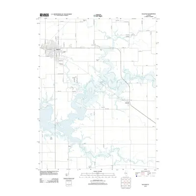
2012 Map of Sullivan
USGS Topo · Published 2012About this map
The town of Sullivan serves as the central hub in this survey of Moultrie County, where a grid of rural roads meets the intricate shoreline of Lake Shelbyville. The landscape is dominated by the sprawling waters of the lake and the Kaskaskia River, which weave through the central and southern portions of the map. This area is particularly rich in family and community history, evidenced by a high density of small cemeteries such as Daugherty Cem, Purvis Cem, and French Cem located near the water's edge. To the east, the settlement of Allenville sits along a railway line, while the Masonic Home and its accompanying Masonic Cem represent significant local landmarks. The presence of Jean Wood Airport near the small community of Bruce highlights the modern infrastructure supporting this primarily agricultural and recreational region.
Find a feature on this map
64 named features on this map. Tap any name to fly to it.
Don’t see what you’re looking for? This feature index may not catch every label — zoom into the map to look around manually.
Map Details
Editions of this 2012 Sullivan Map
This is the sole edition of this map. No revisions or reprints were ever made.
Other maps of this area

1934 · Mattoon
USGS Topo · 1:62,500

1935 · Arcola
USGS Topo · 1:48,000

1935 · Sullivan
USGS Topo · 1:48,000

1937 · Mattoon
USGS Topo · 1:62,500

1940 · Sullivan
USGS Topo · 1:62,500

1940 · Arcola
USGS Topo · 1:62,500

1947 · Stewardson
USGS Topo · 1:62,500

1949 · Stewardson
USGS Topo · 1:62,500

1958 · Decatur
USGS Topo · 1:250,000

1961 · Decatur
USGS Topo · 1:250,000