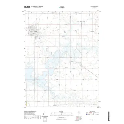
2021 Map of Sullivan
USGS Topo · Published 2021About this map
Sullivan serves as the primary hub in this central Illinois landscape, where the grid of city streets like Jackson St and W Adams St meets the irregular shoreline of Lake Shelbyville. The area is characterized by a high density of small family and community burial grounds, including the Illinois Masonic Home Cem and Greenhill Cem near the town center, as well as the more remote Purvis Cem and Daugherty Cem situated among the agricultural tracts to the east. The terrain is defined by the winding course of the Kaskaskia River and several tributaries such as Jonathan Creek and Whitley Cr, which feed into the large reservoir. Smaller settlements like Allenville and Bruce anchor the surrounding rural areas, connected by a network of county roads that follow the section lines of the original land surveys.
Find a feature on this map
60 named features on this map. Tap any name to fly to it.
Don’t see what you’re looking for? This feature index may not catch every label — zoom into the map to look around manually.
Map Details
Editions of this 2021 Sullivan Map
This is the sole edition of this map. No revisions or reprints were ever made.
Other maps of this area

1934 · Mattoon
USGS Topo · 1:62,500

1935 · Arcola
USGS Topo · 1:48,000

1935 · Sullivan
USGS Topo · 1:48,000

1937 · Mattoon
USGS Topo · 1:62,500

1940 · Sullivan
USGS Topo · 1:62,500

1940 · Arcola
USGS Topo · 1:62,500

1947 · Stewardson
USGS Topo · 1:62,500

1949 · Stewardson
USGS Topo · 1:62,500

1958 · Decatur
USGS Topo · 1:250,000

1961 · Decatur
USGS Topo · 1:250,000