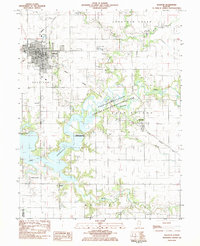
1983 Map of Sullivan
USGS Topo · Published 1983About this map
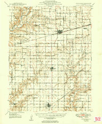
The Moultrie County seat of Sullivan serves as the central hub of this 1980s landscape, where the Illinois Central Gulf railroad intersects a town marked by civic landmarks like City Hall and the Masonic Home. The eastern and southern portions of the sheet are defined by the expansive waters of Lake Shelbyville and the Kaskaskia River State Fish and Wildlife Management Area, reflecting the region's importance for conservation and water management.
Find a feature on this map
42 named features on this map. Tap any name to fly to it.
Don’t see what you’re looking for? This feature index may not catch every label — zoom into the map to look around manually.
Map Details
Editions of this 1983 Sullivan Map
This is the sole edition of this map. No revisions or reprints were ever made.
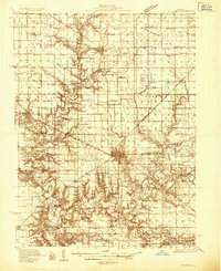
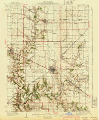
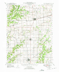
Other maps of this area

1934 · Mattoon
USGS Topo · 1:62,500

1935 · Arcola
USGS Topo · 1:48,000
1935 · Sullivan
USGS Topo · 1:48,000

1937 · Mattoon
USGS Topo · 1:62,500
1940 · Sullivan
USGS Topo · 1:62,500

1940 · Arcola
USGS Topo · 1:62,500
1947 · Stewardson
USGS Topo · 1:62,500
1949 · Stewardson
USGS Topo · 1:62,500

1958 · Decatur
USGS Topo · 1:250,000

1961 · Decatur
USGS Topo · 1:250,000