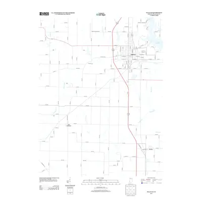
2013 Map of Sullivan
USGS Topo · Published 2013About this map
Sullivan's urban grid and the surrounding agricultural landscape of Sullivan County define this 2013 survey. The city serves as a hub for the region, characterized by its residential street network including N Main St and E Washington St, while the Sullivan County Airport sits to the northwest near W Wolfe St. The terrain is shaped by a complex drainage system where Buck Cr and Busseron Cr converge south of town, reflecting the hydraulic character of the Wabash Valley watershed. To the east, Lake Sullivan provides a significant water feature with residential developments along N Lakeview Dr. Smaller settlements like New Lebanon and Paxton maintain their identity along the county's rural road corridors, while the presence of the Prrd railroad line indicates the enduring role of rail transport in the local economy. Traceable watercourses such as Turtle Cr and Buttermilk Cr cut through the patchwork of section-line roads like Co RD-400 and Co RD-500.
Find a feature on this map
92 named features on this map. Tap any name to fly to it.
Don’t see what you’re looking for? This feature index may not catch every label — zoom into the map to look around manually.
Map Details
Editions of this 2013 Sullivan Map
This is the sole edition of this map. No revisions or reprints were ever made.
Other maps of this area

1917 · Birds
USGS Topo · 1:62,500

1942 · Fairbanks
USGS Topo · 1:24,000

1942 · Shelburn
USGS Topo · 1:24,000

1942 · Birds
USGS Topo · 1:62,500

1943 · Merom
USGS Topo · 1:24,000

1943 · Hymera
USGS Topo · 1:24,000

1943 · Carlisle
USGS Topo · 1:24,000

1943 · Sullivan
USGS Topo · 1:24,000

1943 · Dugger
USGS Topo · 1:24,000

1944 · Bucktown
USGS Topo · 1:24,000