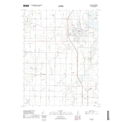
2019 Map of Sullivan
USGS Topo · Published 2019About this map
Sullivan serves as the primary hub of this west-central Indiana landscape, where the town grid transitions into a vast network of section-line roads and family farmsteads. The area is particularly rich in genealogical sites, featuring numerous small burial grounds such as Burnett Cem, Center Ridge Cem, and McCammon Cem scattered across the countryside. The presence of Sullivan County Airport northwest of the city center and the expansive waters of Lake Sullivan highlight the modern infrastructure supporting the community.
Find a feature on this map
137 named features on this map. Tap any name to fly to it.
Don’t see what you’re looking for? This feature index may not catch every label — zoom into the map to look around manually.
Map Details
Editions of this 2019 Sullivan Map
This is the sole edition of this map. No revisions or reprints were ever made.
Other maps of this area

1917 · Birds
USGS Topo · 1:62,500

1942 · Fairbanks
USGS Topo · 1:24,000

1942 · Shelburn
USGS Topo · 1:24,000

1942 · Birds
USGS Topo · 1:62,500

1943 · Merom
USGS Topo · 1:24,000

1943 · Hymera
USGS Topo · 1:24,000

1943 · Carlisle
USGS Topo · 1:24,000

1943 · Sullivan
USGS Topo · 1:24,000

1943 · Dugger
USGS Topo · 1:24,000

1944 · Bucktown
USGS Topo · 1:24,000