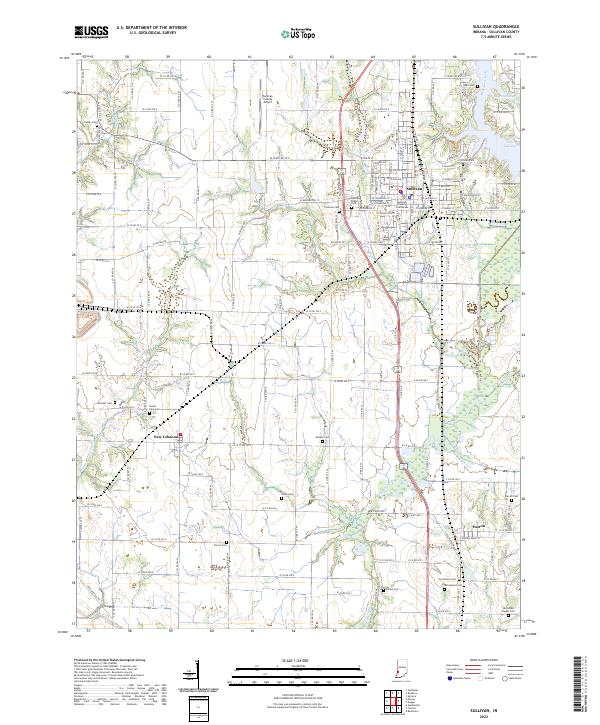
2022 Map of Sullivan
USGS Topo · Published 2022About this map
The Sullivan County Courthouse stands as the central landmark of this Indiana county seat, anchoring a grid of streets that transition into the agricultural landscape of the Wabash Valley. The region is marked by a dense concentration of lineage-rich sites, including the expansive Center Ridge Cem and Timmons Cem near the town center. To the west, the settlement of New Lebanon sits near the winding paths of Turtle Cr and Little Turtle Cr, while Paxton serves the southern reaches of the quadrangle.
Find a feature on this map
80 named features on this map. Tap any name to fly to it.
Don’t see what you’re looking for? This feature index may not catch every label — zoom into the map to look around manually.
Map Details
Editions of this 2022 Sullivan Map
This is the sole edition of this map. No revisions or reprints were ever made.
Other maps of this area

1917 · Birds
USGS Topo · 1:62,500

1942 · Fairbanks
USGS Topo · 1:24,000

1942 · Shelburn
USGS Topo · 1:24,000

1942 · Birds
USGS Topo · 1:62,500

1943 · Merom
USGS Topo · 1:24,000

1943 · Hymera
USGS Topo · 1:24,000

1943 · Carlisle
USGS Topo · 1:24,000

1943 · Sullivan
USGS Topo · 1:24,000

1943 · Dugger
USGS Topo · 1:24,000

1944 · Bucktown
USGS Topo · 1:24,000