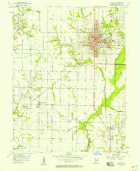
1956 Map of Sullivan
USGS Topo · Published 1958About this map
Sullivan serves as the focal point of this mid-century landscape, where the confluence of the Illinois Central and Chicago and Eastern Illinois railroads anchors the regional economy. The grid of the county seat is clearly defined, featuring the Courthouse, Sherman Hospital, and the local High Sch. Beyond the urban center, the geography transitions into the agricultural townships of Turman, Hamilton, and Haddon, where the land is drained by Busseron Creek and its tributaries like Buttermilk Creek.
Find a feature on this map
46 named features on this map. Tap any name to fly to it.
Don’t see what you’re looking for? This feature index may not catch every label — zoom into the map to look around manually.
Map Details
Editions of this 1956 Sullivan Map
This is the sole edition of this map. No revisions or reprints were ever made.
Other maps of this area

1917 · Birds
USGS Topo · 1:62,500

1942 · Fairbanks
USGS Topo · 1:24,000

1942 · Shelburn
USGS Topo · 1:24,000

1942 · Birds
USGS Topo · 1:62,500

1943 · Merom
USGS Topo · 1:24,000

1943 · Hymera
USGS Topo · 1:24,000

1943 · Carlisle
USGS Topo · 1:24,000

1943 · Sullivan
USGS Topo · 1:24,000

1943 · Dugger
USGS Topo · 1:24,000

1944 · Bucktown
USGS Topo · 1:24,000