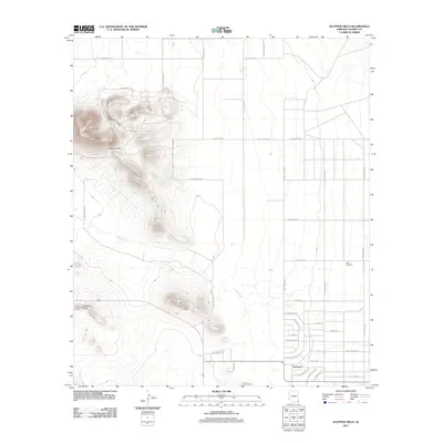
2011 Map of Sulphur Hills
USGS Topo · Published 2011About this map
Sunizona serves as the primary residential hub on this high-desert landscape in the southeastern corner of Arizona. The settlement's gridded street layout, featuring names like E San Carlos Dr and Pete Kitchens Dr, contrasts with the vast open reaches defined by the Sulphur Hills and the winding course of Turkey Creek. This terrain reflects a transition from organized agricultural or residential parcels to the more dramatic topography of Township Butte and Turkey Creek Ridge.
Find a feature on this map
39 named features on this map. Tap any name to fly to it.
Don’t see what you’re looking for? This feature index may not catch every label — zoom into the map to look around manually.
Map Details
Editions of this 2011 Sulphur Hills Map
This is the sole edition of this map. No revisions or reprints were ever made.
Other maps of this area

1916 · Pearce
USGS Topo · 1:125,000

1922 · Willcox
USGS Topo · 1:125,000

1926 · Light
USGS Topo · 1:62,500

1926 · Courtland
USGS Topo · 1:62,500

1943 · Dos Cabezas
USGS Topo · 1:62,500

1943 · Cochise
USGS Topo · 1:62,500

1954 · Silver City
USGS Topo · 1:250,000

1955 · Douglas
USGS Topo · 1:250,000

1957 · Dos Cabezas
USGS Topo · 1:62,500

1958 · Silver City
USGS Topo · 1:250,000