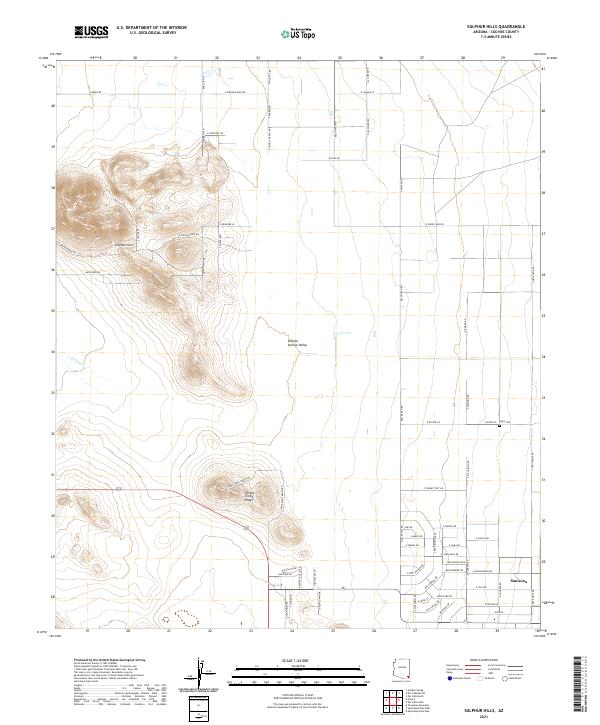
2021 Map of Sulphur Hills
USGS Topo · Published 2021About this map
Sulphur Springs Valley dominates this portion of Cochise County, where the desert landscape is defined by the prominent Sulphur Hills and the elongated Turkey Creek Ridge. The settlement of Sunizona anchors the southeastern corner, serving as a focal point for the surrounding rural homesteads and ranching operations. Traces of early land use are visible through the extensive network of ranch roads, such as E Parker Ranch Rd and S West Well Ranch Rd, which weave between the dry drainages of Turkey Cr. In the eastern section, the Light Cem provides a specific point of interest for genealogists tracing local families. This 2021 edition provides an exceptionally detailed look at modern rural Arizona, illustrating how established ranching boundaries and small desert communities persist amidst the basin-and-range topography.
Find a feature on this map
75 named features on this map. Tap any name to fly to it.
Don’t see what you’re looking for? This feature index may not catch every label — zoom into the map to look around manually.
Map Details
Editions of this 2021 Sulphur Hills Map
This is the sole edition of this map. No revisions or reprints were ever made.
Other maps of this area

1916 · Pearce
USGS Topo · 1:125,000

1922 · Willcox
USGS Topo · 1:125,000

1926 · Light
USGS Topo · 1:62,500

1926 · Courtland
USGS Topo · 1:62,500

1943 · Dos Cabezas
USGS Topo · 1:62,500

1943 · Cochise
USGS Topo · 1:62,500

1954 · Silver City
USGS Topo · 1:250,000

1955 · Douglas
USGS Topo · 1:250,000

1957 · Dos Cabezas
USGS Topo · 1:62,500

1958 · Silver City
USGS Topo · 1:250,000