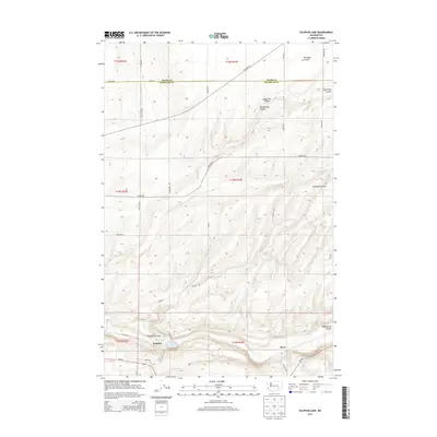
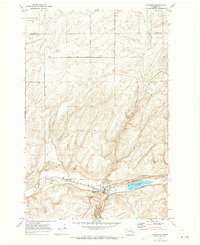
2013 Map of Sulphur Lake
USGS Topo · Published 2013About this map
Sulphur Lake sits at the southern edge of this dry plateau landscape, where the Adams Co and Franklin Co line divides the high country. The terrain is defined by a series of deep erosional features, including the prominent Washtucna Coulee and Hardesty Coulee, which snake across the southeastern portion of the map. These coulees represent the distinct geological history of the region, cutting through the high plains of Michigan Prairie. Small settlements like Sulphur and Estes are positioned near the intersection of Wa-260 and Delaney Rd, illustrating the sparse but deliberate placement of infrastructure in this agricultural and pastoral environment. A network of rural roads, such as Lone Star Rd and Hoover Rd, provides the primary access to the scattered canyons and coulees that break the flat horizon.
Find a feature on this map
33 named features on this map. Tap any name to fly to it.
Don’t see what you’re looking for? This feature index may not catch every label — zoom into the map to look around manually.
Map Details
Editions of this 2013 Sulphur Lake Map
This is the sole edition of this map. No revisions or reprints were ever made.
Other maps of this area

1916 · Connell
USGS Topo · 1:125,000

1918 · Connell
USGS Topo · 1:125,000

1953 · Walla Walla
USGS Topo · 1:250,000

1958 · Walla Walla
USGS Topo · 1:250,000
1970 · Burr Canyon
USGS Topo · 1:24,000
1970 · Lower Monumental Dam
USGS Topo · 1:24,000

1970 · Lind SE
USGS Topo · 1:24,000

1970 · Lind SW
USGS Topo · 1:24,000
1970 · Connell SE
USGS Topo · 1:24,000
1970 · Kahlotus
USGS Topo · 1:24,000