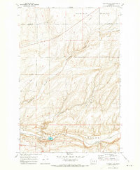
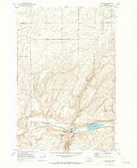
1970 Map of Sulphur Lake
USGS Topo · Published 1973About this map
Washtucna (Depression) Coulee dominates the southern landscape of this 1970 survey, where the Union Pacific railroad tracks follow the low-lying terrain. The map details a specialized agricultural and industrial corridor focused around Sulphur Lake and the small settlements of Sulphur and Estes. Multiple Grain Elevator sites and Borrow Pits along the rail line underscore the region's reliance on both shipping and local extraction. To the north, the terrain shifts into the higher ground of Michigan Prairie, deeply incised by drainage features like Rattlesnake Canyon and Sand Hills Coulee. This transition from the flat coulee floor to the rugged uplands is marked by a network of rural routes, including Lone Star Road and Lauer Road, which connected scattered homesteads and points of interest like Mc Nicholas at the start of the decade.
Find a feature on this map
28 named features on this map. Tap any name to fly to it.
Don’t see what you’re looking for? This feature index may not catch every label — zoom into the map to look around manually.
Map Details
Editions of this 1970 Sulphur Lake Map
This is the sole edition of this map. No revisions or reprints were ever made.
Other maps of this area

1916 · Connell
USGS Topo · 1:125,000

1918 · Connell
USGS Topo · 1:125,000

1953 · Walla Walla
USGS Topo · 1:250,000

1958 · Walla Walla
USGS Topo · 1:250,000
1970 · Burr Canyon
USGS Topo · 1:24,000
1970 · Lower Monumental Dam
USGS Topo · 1:24,000

1970 · Lind SE
USGS Topo · 1:24,000

1970 · Lind SW
USGS Topo · 1:24,000
1970 · Connell SE
USGS Topo · 1:24,000
1970 · Kahlotus
USGS Topo · 1:24,000