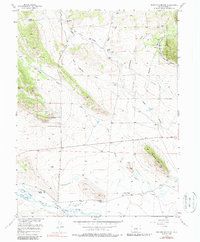
1956 Map of Sulphur Mountain
USGS Topo · Published 1987About this map
The Middle Fork South Platte River winds through the southern reaches of this landscape, its waters channeled by an intricate system of irrigation infrastructure including the Harrington Ditch and the South Ditch. This mid-century survey illustrates a ranching economy in transition, where working homesteads like the Buckley Ranch, Harrington Ranch, and Spinney Ranch are established alongside the developing Pike-San Isabel Village. The map reveals the repurposing of industrial history for water management, specifically noting the Old Railroad Grade Ditch, indicating where former rail infrastructure was adapted for local utility.
Find a feature on this map
66 named features on this map. Tap any name to fly to it.
Don’t see what you’re looking for? This feature index may not catch every label — zoom into the map to look around manually.
Map Details
Editions of this 1956 Sulphur Mountain Map
3 editions found
Other maps of this area

1953 · Denver
USGS Topo · 1:250,000

1954 · Pueblo
USGS Topo · 1:250,000

1956 · Eagle Rock
USGS Topo · 1:24,000

1956 · Elkhorn
USGS Topo · 1:24,000

1956 · Sulphur Mountain
USGS Topo · 1:24,000

1956 · Farnum Peak
USGS Topo · 1:24,000

1956 · Antero Reservoir NE
USGS Topo · 1:24,000

1956 · Hartsel
USGS Topo · 1:24,000

1956 · Guffey NW
USGS Topo · 1:24,000

1956 · Glentivar
USGS Topo · 1:24,000