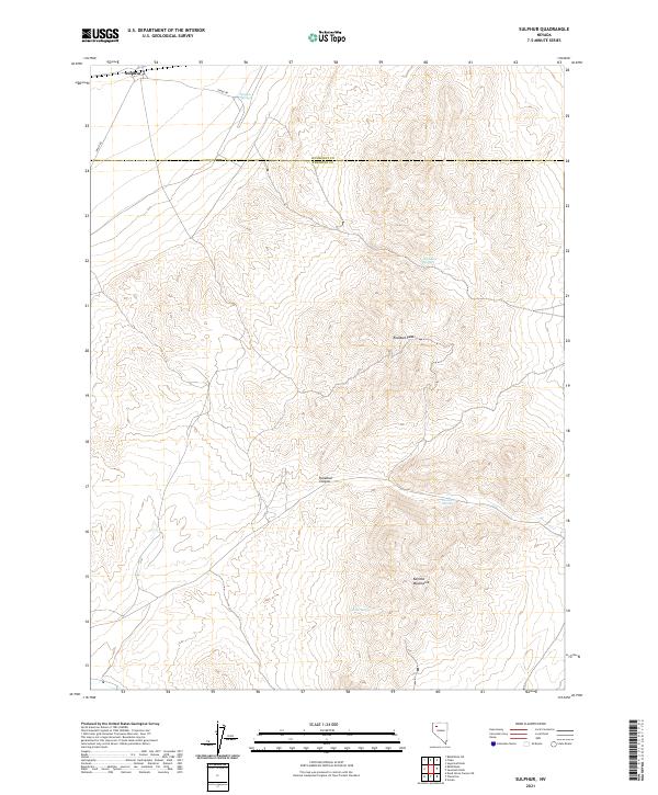
2021 Map of Sulphur
USGS Topo · Published 2021About this map
The settlement of Sulphur lies at the northern edge of the desert, where Jungo Rd cuts through the basin just across the line between Humboldt and Pershing counties. This 2021 study documents the high-desert terrain of the Kamma Mountains, dominated by Rosebud Peak and the winding course of Rosebud Canyon. Groundwater is the defining feature of the landscape's history, marked by a string of reliable water sources including Sulphur Springs, Wild Rose Spring, Rosebud Spring, and Lander Spring. These springs provided vital stops in an otherwise arid environment, dictating the routes taken by travelers and the locations of seasonal camps. The map provides a contemporary view of the public land surveys, showing the intersection of several townships including t34n r29e and t35n r30e within the Great Basin.
Find a feature on this map
16 named features on this map. Tap any name to fly to it.
Don’t see what you’re looking for? This feature index may not catch every label — zoom into the map to look around manually.
Map Details
Editions of this 2021 Sulphur Map
This is the sole edition of this map. No revisions or reprints were ever made.
Other maps of this area

1931 · Lovelock
USGS Topo · 1:250,000

1935 · Lovelock
USGS Topo · 1:250,000

1955 · Lovelock
USGS Topo · 1:250,000

1959 · Lovelock
USGS Topo · 1:250,000
1981 · Rabbithole NE
USGS Topo · 1:24,000
1981 · Sawtooth Knob
USGS Topo · 1:24,000

1981 · Dead Horse Canyon NE
USGS Topo · 1:24,000

1981 · Scossa
USGS Topo · 1:24,000

1981 · Placerites
USGS Topo · 1:24,000
1981 · Sugarloaf Knob
USGS Topo · 1:24,000