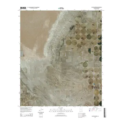
2014 Map of Sulphur Spring
USGS Topo · Published 2014About this map
Willcox Playa dominates the northwestern portion of this landscape, its expansive alkaline basin suggesting a prehistoric lakebed in this corner of Cochise County. The Kansas Settlement anchors the eastern edge, where a structured grid of rural roads like S Kansas Settlement Rd and E Baker Rd indicates a territory organized for agriculture and irrigation. Near the center, Sulphur Spring and the Sulphur Springs Cem provide a focal point for local genealogy and regional history, marking a site that has long served as a vital water source in the desert. To the south, the terrain shifts toward the volcanic profile of the Three Sisters Buttes, while local aviation history is preserved at the Leroy Airport near the northern boundary.
Find a feature on this map
36 named features on this map. Tap any name to fly to it.
Don’t see what you’re looking for? This feature index may not catch every label — zoom into the map to look around manually.
Map Details
Editions of this 2014 Sulphur Spring Map
This is the sole edition of this map. No revisions or reprints were ever made.
Other maps of this area

1916 · Pearce
USGS Topo · 1:125,000

1922 · Willcox
USGS Topo · 1:125,000

1926 · Light
USGS Topo · 1:62,500

1926 · Courtland
USGS Topo · 1:62,500

1943 · Dos Cabezas
USGS Topo · 1:62,500

1943 · Cochise
USGS Topo · 1:62,500

1954 · Silver City
USGS Topo · 1:250,000

1955 · Douglas
USGS Topo · 1:250,000

1957 · Dos Cabezas
USGS Topo · 1:62,500

1958 · Silver City
USGS Topo · 1:250,000