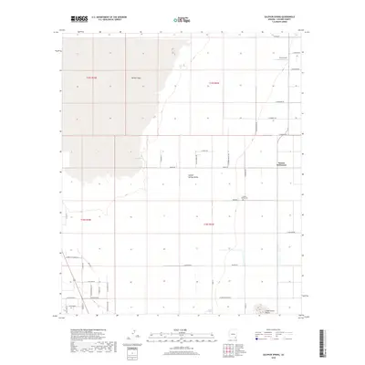
2018 Map of Sulphur Spring
USGS Topo · Published 2018About this map
Sulphur Springs Valley defines this arid landscape in Cochise County, where the sprawling Willcox Playa dominates the northwestern terrain. This high-desert basin is characterized by a sparse grid of roads supporting the Kansas Settlement and various agricultural interests. Genealogists and local historians can locate the Sulphur Springs Cem situated off Baker Rd, while aviation researchers will find Leroy Airport in the northeast. The southern portion of the survey is marked by the distinctive Three Sisters Buttes rising near Sulphur Spring. The map documents a wide network of local routes, including Kimzey Rd and Chambers Rd, which connect the remote ranching and farming tracts of this unique Arizona corridor.
Find a feature on this map
46 named features on this map. Tap any name to fly to it.
Don’t see what you’re looking for? This feature index may not catch every label — zoom into the map to look around manually.
Map Details
Editions of this 2018 Sulphur Spring Map
This is the sole edition of this map. No revisions or reprints were ever made.
Other maps of this area

1916 · Pearce
USGS Topo · 1:125,000

1922 · Willcox
USGS Topo · 1:125,000

1926 · Light
USGS Topo · 1:62,500

1926 · Courtland
USGS Topo · 1:62,500

1943 · Dos Cabezas
USGS Topo · 1:62,500

1943 · Cochise
USGS Topo · 1:62,500

1954 · Silver City
USGS Topo · 1:250,000

1955 · Douglas
USGS Topo · 1:250,000

1957 · Dos Cabezas
USGS Topo · 1:62,500

1958 · Silver City
USGS Topo · 1:250,000