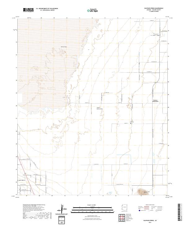
2021 Map of Sulphur Spring
USGS Topo · Published 2021About this map
Sulphur Springs Valley defines this arid landscape in Cochise County, where the sprawling basin of Willcox Playa dominates the western half of the quadrangle. This ephemeral dry lake bed transitions into a network of agricultural and ranching lands to the east, anchored by the Kansas Settlement. The human geography of the area is marked by a strict grid of section lines and gravel roads, including Kansas Settlement Rd and S Chambers Ranch Rd, reflecting the large-scale irrigation and cattle operations typical of the region. Local history is anchored at the Sulphur Springs Cem, while the small Leroy Airport and the named Sulphur Spring itself point to the critical role of transportation and water in this high-desert environment. To the south, the Three Sisters Buttes provide a distinct vertical break in the otherwise level basin floor.
Find a feature on this map
48 named features on this map. Tap any name to fly to it.
Don’t see what you’re looking for? This feature index may not catch every label — zoom into the map to look around manually.
Map Details
Editions of this 2021 Sulphur Spring Map
This is the sole edition of this map. No revisions or reprints were ever made.
Other maps of this area

1916 · Pearce
USGS Topo · 1:125,000

1922 · Willcox
USGS Topo · 1:125,000

1926 · Light
USGS Topo · 1:62,500

1926 · Courtland
USGS Topo · 1:62,500

1943 · Dos Cabezas
USGS Topo · 1:62,500

1943 · Cochise
USGS Topo · 1:62,500

1954 · Silver City
USGS Topo · 1:250,000

1955 · Douglas
USGS Topo · 1:250,000

1957 · Dos Cabezas
USGS Topo · 1:62,500

1958 · Silver City
USGS Topo · 1:250,000