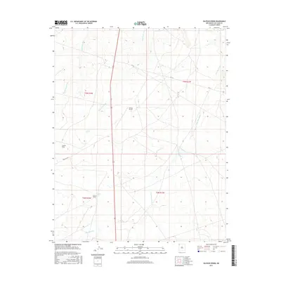
2017 Map of Sulphur Spring
USGS Topo · Published 2017About this map
Sulphur Spring and several seasonal watercourses define the arid landscape of this San Juan County region within the Shiprock Agency. The area is characterized by a sparse network of modern roads and infrastructure, including Red Rock Hwy and Hwy 36, which cut through a terrain marked by prominent landmarks such as Cactus Peak. The inclusion of the Shiprock Airstrip and specific water sources like 112R-78 Spring highlights the practical navigation and resource management required in this high-desert environment. These ephemeral drainages, notably Many Devils Wash, Dead Mans Wash, and Rattlesnake Wash, create a complex hydrologic pattern that has historically dictated the movement of people and livestock through the territory.
Find a feature on this map
13 named features on this map. Tap any name to fly to it.
Don’t see what you’re looking for? This feature index may not catch every label — zoom into the map to look around manually.
Map Details
Editions of this 2017 Sulphur Spring Map
This is the sole edition of this map. No revisions or reprints were ever made.
Other maps of this area

1889 · Chaco
USGS Topo · 1:250,000

1892 · Chaco
USGS Topo · 1:250,000

1927 · Sulphur Spring
USGS Topo · 1:96,000

1928 · Kirtland
USGS Topo · 1:125,000

1932 · Kirtland
USGS Topo · 1:125,000

1934 · Ship Rock
USGS Topo · 1:62,500

1934 · Chimney Rock
USGS Topo · 1:62,500

1934 · Rattlesnake
USGS Topo · 1:62,500

1936 · Chimney Rock
USGS Topo · 1:62,500

1937 · Ship Rock
USGS Topo · 1:62,500