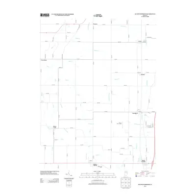
2013 Map of Sulphur Springs
USGS Topo · Published 2013About this map
Sulphur Springs and the surrounding farmland of Henry County are defined by a network of drainage ditches and small creeks that supported this agricultural region into the early 21st century. The landscape is dotted with small, concentrated settlements such as Mount Summit, Springport, and Oakville, many of which originated as railroad stops or rural trade centers. A unique characteristic of this specific area is the presence of small-scale aviation facilities like Roberts Field Airport and the descriptively named The Last Resort Airport, reflecting the local importance of private airstrips in rural Indiana. Water management is a primary feature of the terrain, evidenced by man-made alterations such as Peckinpaugh Ditch, Abshire Ditch, and Sulphur Drain, which channel water from natural runs like Bell Cr and Fall Cr to maximize the productivity of the surrounding fields.
Find a feature on this map
76 named features on this map. Tap any name to fly to it.
Don’t see what you’re looking for? This feature index may not catch every label — zoom into the map to look around manually.
Map Details
Editions of this 2013 Sulphur Springs Map
This is the sole edition of this map. No revisions or reprints were ever made.
Other maps of this area

1949 · New Castle West
USGS Topo · 1:24,000

1950 · New Castle East
USGS Topo · 1:24,000

1952 · Muncie East
USGS Topo · 1:24,000

1952 · Muncie West
USGS Topo · 1:24,000

1953 · Cincinnati
USGS Topo · 1:250,000

1953 · Muncie
USGS Topo · 1:250,000

1956 · Muncie
USGS Topo · 1:250,000

1957 · Cincinnati
USGS Topo · 1:250,000

1960 · Gilman
USGS Topo · 1:24,000

1960 · New Castle West
USGS Topo · 1:24,000