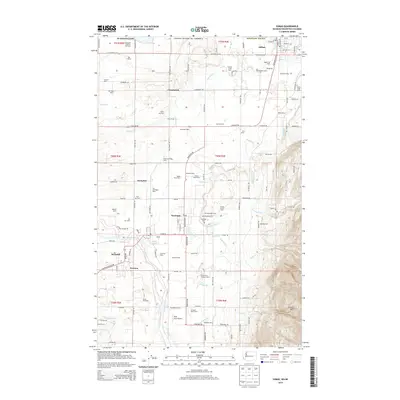
2014 Map of Sumas
USGS Topo · Published 2014About this map
The Sumas River and Nooksack River drainage basins define this borderland region of Whatcom County, where the agricultural legacy of the Pacific Northwest is clearly visible. Numerous family-run dairies and orchards, including Mar G Dairy, Holmquist Hazelnut Orchards, and Veldman Dairy, are plotted across the lowlands between the towns of Sumas and Nooksack. This network of farms is supported by a strict grid of rural roads like Van Buren Rd and Nooksack Rd, illustrating the transition from the flat river valley to the rising slopes of Sumas Mtn in the southeast. Cultural landmarks such as the Nooksack Cem and the Sumas Christian Reformed Church serve as focal points for the surrounding rural communities of Clearbrook and Hampton. The BNSF Railway corridor remains a vital artery, connecting these cross-border settlements to the broader regional economy.
Find a feature on this map
172 named features on this map. Tap any name to fly to it.
Don’t see what you’re looking for? This feature index may not catch every label — zoom into the map to look around manually.
Map Details
Editions of this 2014 Sumas Map
This is the sole edition of this map. No revisions or reprints were ever made.
Other maps of this area

1906 · Sumas
USGS Topo · 1:62,500

1908 · Sumas
USGS Topo · 1:62,500

1919 · Van Zandt
USGS Topo · 1:62,500

1951 · Van Zandt
USGS Topo · 1:62,500

1952 · Lynden
USGS Topo · 1:24,000

1952 · Lawrence
USGS Topo · 1:24,000

1952 · Sumas
USGS Topo · 1:24,000

1954 · Bellingham North
USGS Topo · 1:24,000

1954 · Lynden
USGS Topo · 1:62,500

1957 · Victoria
USGS Topo · 1:250,000