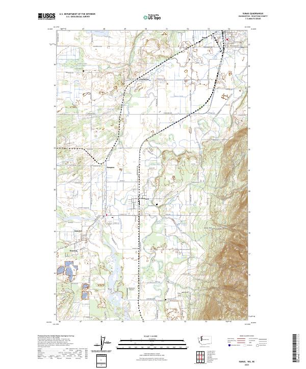
2023 Map of Sumas
USGS Topo · Published 2023About this map
The Sumas River winds through this agricultural borderland, connecting several small settlements and farm communities along the international boundary. In the north, the town of Sumas sits at the edge of the Canadian border, while to the south, the terrain rises toward the slopes of Sumas Mtn. The landscape is defined by its water system, where Johnson Creek, Kinley Creek, and Breckenridge Creek cross a network of country roads like Barbo Rd and Nooksack Rd. Genealogists and local researchers will find significant landmarks throughout the valley, including Lake Side Cem, Nooksack Cem, and Hopewell Cem. The presence of Westwind Airport and Butler Field indicates the mix of rural industry and small-town infrastructure in this part of Whatcom County. Smaller nodes like Clearbrook, Hampton, and Strandell reflect the historical settlement patterns established along the river flats and early transit routes.
Find a feature on this map
99 named features on this map. Tap any name to fly to it.
Don’t see what you’re looking for? This feature index may not catch every label — zoom into the map to look around manually.
Map Details
Editions of this 2023 Sumas Map
This is the sole edition of this map. No revisions or reprints were ever made.
Other maps of this area

1906 · Sumas
USGS Topo · 1:62,500

1908 · Sumas
USGS Topo · 1:62,500

1919 · Van Zandt
USGS Topo · 1:62,500

1951 · Van Zandt
USGS Topo · 1:62,500

1952 · Lynden
USGS Topo · 1:24,000

1952 · Lawrence
USGS Topo · 1:24,000

1952 · Sumas
USGS Topo · 1:24,000

1954 · Bellingham North
USGS Topo · 1:24,000

1954 · Lynden
USGS Topo · 1:62,500

1957 · Victoria
USGS Topo · 1:250,000