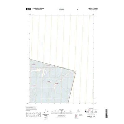
2021 Map of Sumdum A-1 SE
USGS Topo · Published 2021About this map
Tongass National Forest dominates this international boundary region, where the high-altitude ice of LeConte Glacier flows through the steep terrain of the Stikine Icefield. The survey centers on the jagged peak of Kates Needle, a prominent landmark that defines the physical border between the United States and Canada. This 2021 update illustrates the modern extent of glacial features and the precise alignment of the international boundary near the southeastern Alaskan panhandle. The mapping is primarily focused on physical geography rather than human infrastructure, detailing the complex drainage patterns and elevation contours that characterize this high-alpine wilderness.
Find a feature on this map
8 named features on this map. Tap any name to fly to it.
Don’t see what you’re looking for? This feature index may not catch every label — zoom into the map to look around manually.
Map Details
Editions of this 2021 Sumdum A-1 SE Map
This is the sole edition of this map. No revisions or reprints were ever made.
Other maps of this area

1951 · Bradfield Canal
USGS Topo · 1:250,000

1952 · Petersburg
USGS Topo · 1:250,000

1952 · Sumdum
USGS Topo · 1:250,000

1954 · Bradfield Canal
USGS Topo · 1:250,000

1955 · Bradfield canal D-6
USGS Topo · 1:63,360

1955 · Bradfield Canal
USGS Topo · 1:250,000

1960 · Petersburg
USGS Topo · 1:250,000

1960 · Sumdum A-1
USGS Topo · 1:63,360

1961 · Petersburg D-1
USGS Topo · 1:63,360

1961 · Sumdum
USGS Topo · 1:250,000