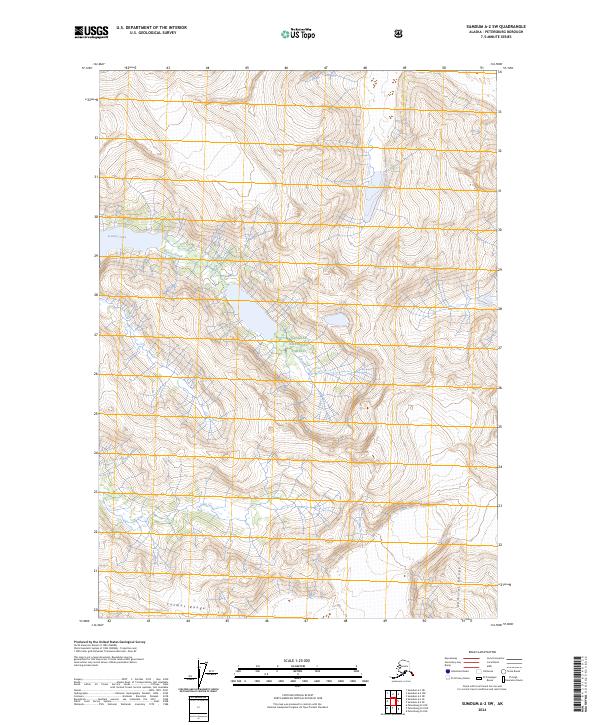
2024 Map of Sumdum A-2 SW
USGS Topo · Published 2024About this map
Tongass National Forest dominates this Alaskan landscape, characterized by the dramatic elevation changes of the Cosmos Range and the Admiral Range. The topography is defined by narrow valley corridors where Scenery Creek and Cascade Creek drain the surrounding heights. A prominent feature is Scenery Lake, which sits at the head of a drainage system carved through the high ridges. This map reveals a largely roadless wilderness where natural hydrology and high-relief terrain dictate the movement of water and the structure of the forest. The sparse naming of features emphasizes the isolation of these peaks and the primary role of the glacial-carved valleys in defining the region's geography within the southeastern Alaskan panhandle.
Find a feature on this map
10 named features on this map. Tap any name to fly to it.
Don’t see what you’re looking for? This feature index may not catch every label — zoom into the map to look around manually.
Map Details
Editions of this 2024 Sumdum A-2 SW Map
This is the sole edition of this map. No revisions or reprints were ever made.
Other maps of this area

1952 · Petersburg
USGS Topo · 1:250,000

1952 · Sumdum
USGS Topo · 1:250,000

1960 · Petersburg
USGS Topo · 1:250,000

1961 · Sumdum A-2
USGS Topo · 1:63,360

1961 · Petersburg D-3
USGS Topo · 1:63,360

1961 · Sumdum A-3
USGS Topo · 1:63,360

1961 · Petersburg D-2
USGS Topo · 1:63,360

1961 · Sumdum
USGS Topo · 1:250,000

1994 · Petersburg D-2
USGS Topo · 1:63,360
1995 · Petersburg D-3
USGS Topo · 1:63,360