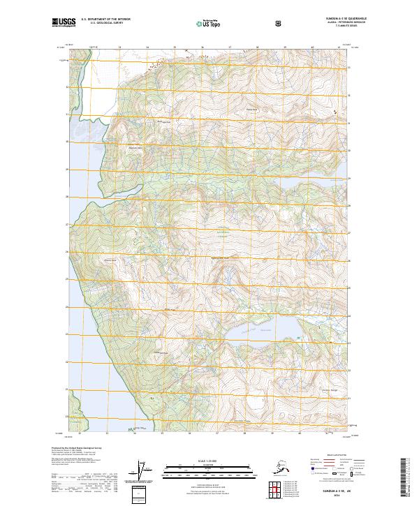
2024 Map of Sumdum A-3 SE
USGS Topo · Published 2024About this map
Tongass National Forest encompasses this coastal Alaskan landscape, where the saltwater of Scenery Cove meets a vertical interior of high summits and glacial drainage. The map reveals a complex hydrological network defined by Cascade Creek and its namesake Cascade Creek Trl, which connects the larger Swan Lake to the tidal waters. To the north and south, the terrain is punctuated by family-named or descriptive peaks such as Elephants Head, Fighting John Peak, and Waterfall Peak. The interior contains several high-altitude water bodies, including Falls Lake and Scenery Lake, illustrating the post-glacial topography of the Cosmos Range. This 2024 data highlights the intricate coastline around Spray Island and the various forks of Scenery Creek, offering a detailed view of the wilderness interface between the mountains and the sea.
Find a feature on this map
25 named features on this map. Tap any name to fly to it.
Don’t see what you’re looking for? This feature index may not catch every label — zoom into the map to look around manually.
Map Details
Editions of this 2024 Sumdum A-3 SE Map
This is the sole edition of this map. No revisions or reprints were ever made.
Other maps of this area

1952 · Petersburg
USGS Topo · 1:250,000

1952 · Sumdum
USGS Topo · 1:250,000

1960 · Petersburg
USGS Topo · 1:250,000

1961 · Sumdum A-2
USGS Topo · 1:63,360

1961 · Petersburg D-3
USGS Topo · 1:63,360

1961 · Sumdum A-3
USGS Topo · 1:63,360

1961 · Petersburg D-2
USGS Topo · 1:63,360

1961 · Sumdum
USGS Topo · 1:250,000

1994 · Petersburg D-2
USGS Topo · 1:63,360
1995 · Petersburg D-3
USGS Topo · 1:63,360