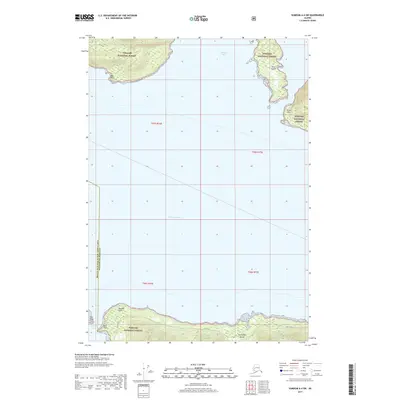
2017 Map of Sumdum A-4 SW
USGS Topo · Published 2017About this map
Frederick Sound dominates this coastal landscape within the Tongass National Forest, illustrating the intricate shoreline of the Alexander Archipelago. This survey focuses on the maritime intersections of the Petersburg Borough boundary as it traverses open water and rugged islands. The northern portion of the map is defined by the entrance to Farragut Bay, guarded by Read Island and Grand Point. To the south, the northern coastline of Kupreanof Island reveals a series of prominent navigational markers, including Boulder Point and the passage through Cape Strait. The absence of developed roads or settlements highlights the isolation of these forested reaches, where transport relied entirely on the waterways connecting Portage Bay to the larger sound.
Find a feature on this map
17 named features on this map. Tap any name to fly to it.
Don’t see what you’re looking for? This feature index may not catch every label — zoom into the map to look around manually.
Map Details
Editions of this 2017 Sumdum A-4 SW Map
This is the sole edition of this map. No revisions or reprints were ever made.
Other maps of this area

1948 · Sumdum A-4
USGS Topo · 1:63,360

1948 · Sumdum A-5
USGS Topo · 1:63,360

1948 · Petersburg D-5
USGS Topo · 1:63,360

1951 · Petersburg D-4
USGS Topo · 1:63,360

1951 · Sumdum A-4
USGS Topo · 1:63,360

1952 · Petersburg
USGS Topo · 1:250,000

1952 · Sumdum
USGS Topo · 1:250,000

1960 · Petersburg
USGS Topo · 1:250,000

1961 · Sumdum
USGS Topo · 1:250,000
1995 · Petersburg D-4
USGS Topo · 1:63,360