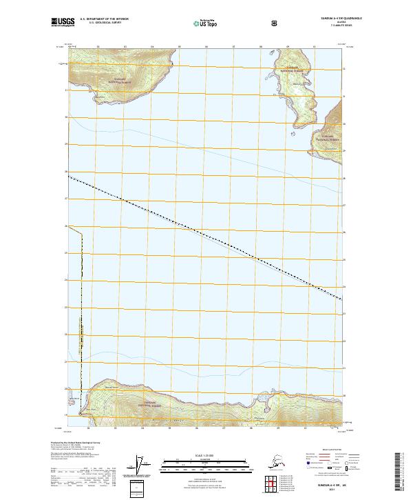
2021 Map of Sumdum A-4 SW
USGS Topo · Published 2021About this map
Kupreanof Island defines the southern reach of this coastal survey, where the peaks of the Missionary Range rise abruptly from the shoreline. Located within the expansive Tongass National Forest, the map details a maritime landscape of significant points and sheltered waters at the meeting of the Petersburg Borough boundary. The northern waters of Farragut Bay and the southern inlets of Portage Bay frame a complex network of coastal features, including Read Island and several prominent navigational landmarks like Boulder Point and Grand Point. This 2021 update from the U.S. Geological Survey provides a precise account of the shoreline and elevation contours, illustrating the unpopulated and heavily timbered character of this Southeast Alaska wilderness before any modern industrial or residential expansion.
Find a feature on this map
16 named features on this map. Tap any name to fly to it.
Don’t see what you’re looking for? This feature index may not catch every label — zoom into the map to look around manually.
Map Details
Editions of this 2021 Sumdum A-4 SW Map
This is the sole edition of this map. No revisions or reprints were ever made.
Other maps of this area

1948 · Sumdum A-4
USGS Topo · 1:63,360

1948 · Sumdum A-5
USGS Topo · 1:63,360

1948 · Petersburg D-5
USGS Topo · 1:63,360

1951 · Petersburg D-4
USGS Topo · 1:63,360

1951 · Sumdum A-4
USGS Topo · 1:63,360

1952 · Petersburg
USGS Topo · 1:250,000

1952 · Sumdum
USGS Topo · 1:250,000

1960 · Petersburg
USGS Topo · 1:250,000

1961 · Sumdum
USGS Topo · 1:250,000
1995 · Petersburg D-4
USGS Topo · 1:63,360