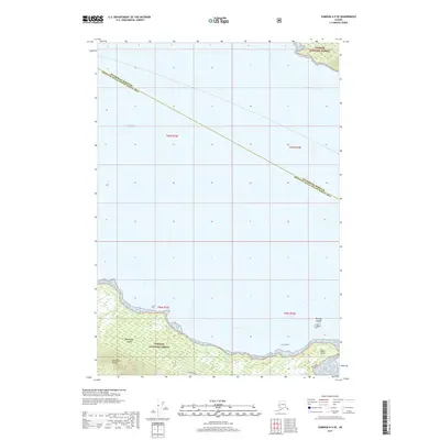
2017 Map of Sumdum A-5 SE
USGS Topo · Published 2017About this map
Kupreanof Island dominates the southern landscape of this coastal survey, where the peaks of the Bohemian Range rise sharply from the shoreline of Frederick Sound. Much of the terrestrial area is protected within the Tongass National Forest, reflecting the region's managed wilderness character in the early 21st century. The map illustrates a complex maritime environment at the intersection of the Petersburg Borough and Prince of Wales-Hyder Census Area. Small landforms such as the Portage Islands and West Point mark the transition from open water to the sheltered waters of Goose Cove, providing a detailed look at the island's jagged coastline and the bathymetry of the surrounding sound.
Find a feature on this map
12 named features on this map. Tap any name to fly to it.
Don’t see what you’re looking for? This feature index may not catch every label — zoom into the map to look around manually.
Map Details
Editions of this 2017 Sumdum A-5 SE Map
This is the sole edition of this map. No revisions or reprints were ever made.
Other maps of this area

1948 · Sumdum A-4
USGS Topo · 1:63,360

1948 · Sumdum A-5
USGS Topo · 1:63,360

1948 · Petersburg D-5
USGS Topo · 1:63,360

1951 · Petersburg D-4
USGS Topo · 1:63,360

1951 · Sumdum A-4
USGS Topo · 1:63,360

1952 · Petersburg
USGS Topo · 1:250,000

1952 · Sumdum
USGS Topo · 1:250,000

1960 · Petersburg
USGS Topo · 1:250,000

1961 · Sumdum
USGS Topo · 1:250,000
1995 · Petersburg D-4
USGS Topo · 1:63,360