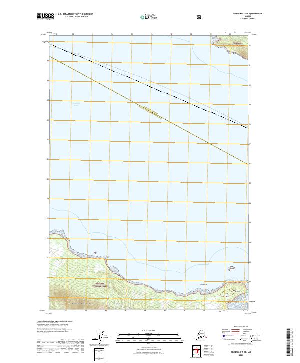
2021 Map of Sumdum A-5 SE
USGS Topo · Published 2021About this map
The Tongass National Forest dominates the terrestrial landscape of this maritime map, covering the northern and southern coastlines that border Frederick Sound. To the south, the Bohemian Range rises above the shoreline, providing a dramatic backdrop to coastal features like Goose Cove. This survey documents the boundary between Petersburg Borough and the Prince of Wales-Hyder Census Area, which cuts diagonally across the open water. Navigational points and landmarks such as West Point and the Portage Islands provide essential orientation in this primarily aquatic environment, where the geography is defined by the reaching arms of the sea and the protected timberlands of the national forest.
Find a feature on this map
12 named features on this map. Tap any name to fly to it.
Don’t see what you’re looking for? This feature index may not catch every label — zoom into the map to look around manually.
Map Details
Editions of this 2021 Sumdum A-5 SE Map
This is the sole edition of this map. No revisions or reprints were ever made.
Other maps of this area

1948 · Sumdum A-4
USGS Topo · 1:63,360

1948 · Sumdum A-5
USGS Topo · 1:63,360

1948 · Petersburg D-5
USGS Topo · 1:63,360

1951 · Petersburg D-4
USGS Topo · 1:63,360

1951 · Sumdum A-4
USGS Topo · 1:63,360

1952 · Petersburg
USGS Topo · 1:250,000

1952 · Sumdum
USGS Topo · 1:250,000

1960 · Petersburg
USGS Topo · 1:250,000

1961 · Sumdum
USGS Topo · 1:250,000
1995 · Petersburg D-4
USGS Topo · 1:63,360