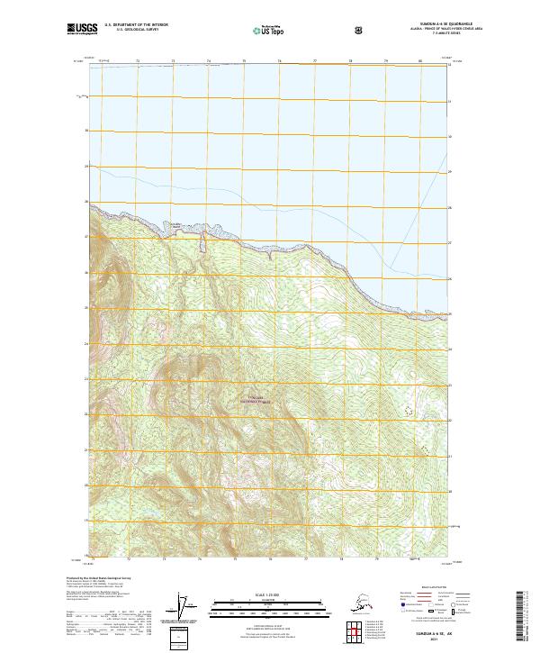
2021 Map of Sumdum A-6 SE
USGS Topo · Published 2021About this map
Tongass National Forest dominates the southern landscape of this 2021 survey, where the dense timber of the Alaskan panhandle meets the coastline. The terrain is defined by steep elevation gains, marked by the flow of Gunn Creek as it descends toward the northern shore. Small landforms like Schooner Island sit just off the coast, providing navigational landmarks along the water's edge. This modern digital survey utilizes National Elevation Dataset contours to chart the complex topography within the Public Land Survey System grids, including t56s r73e and t55s r74e. The map reflects a landscape primarily dedicated to federal forest management, where the intersection of maritime features and protected inland wilderness remains the defining characteristic.
Find a feature on this map
7 named features on this map. Tap any name to fly to it.
Don’t see what you’re looking for? This feature index may not catch every label — zoom into the map to look around manually.
Map Details
Editions of this 2021 Sumdum A-6 SE Map
This is the sole edition of this map. No revisions or reprints were ever made.
Other maps of this area

1948 · Sumdum A-5
USGS Topo · 1:63,360

1948 · Sumdum A-6
USGS Topo · 1:63,360

1948 · Petersburg D-6
USGS Topo · 1:63,360

1948 · Petersburg D-5
USGS Topo · 1:63,360

1951 · Petersburg D-6
USGS Topo · 1:63,360

1952 · Petersburg
USGS Topo · 1:250,000

1952 · Sumdum
USGS Topo · 1:250,000

1960 · Petersburg
USGS Topo · 1:250,000

1961 · Sumdum
USGS Topo · 1:250,000
1994 · Sumdum A-6
USGS Topo · 1:63,360