
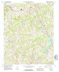
1969 Map of Summerfield
USGS Topo · Published 1972About this map
Summerfield and Oak Ridge anchor this late-1960s landscape, where rural agricultural traditions began to meet the growing suburban footprint of Guilford County. The Southern railroad line cuts diagonally across the northern terrain, passing through Stokesdale and Ogburns Crossroads, while a dense network of local routes like Scalesville Road and Carlson Dairy Road connect numerous small community centers.
Find a feature on this map
43 named features on this map. Tap any name to fly to it.
Don’t see what you’re looking for? This feature index may not catch every label — zoom into the map to look around manually.
Map Details
Editions of this 1969 Summerfield Map
2 editions found
Other maps of this area

1951 · Guilford
USGS Topo · 1:24,000

1951 · Lake Brandt
USGS Topo · 1:24,000

1951 · Greensboro
USGS Topo · 1:24,000

1953 · Winston-Salem
USGS Topo · 1:250,000

1953 · Greensboro
USGS Topo · 1:250,000

1954 · Greensboro
USGS Topo · 1:250,000

1955 · Winston-Salem
USGS Topo · 1:250,000

1962 · Winston-Salem
USGS Topo · 1:250,000

1962 · Greensboro
USGS Topo · 1:250,000

1966 · Greensboro
USGS Topo · 1:250,000