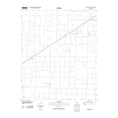
2010 Map of Summerfield
USGS Topo · Published 2010About this map
Summerfield and the settlement of Black anchor this High Plains landscape, where the geometry of the Texas Panhandle is defined by a rigorous grid of county roads. Bisecting the territory is a major transportation corridor that links these small communities, running parallel to the drainage of Frio Draw. This seasonal watercourse meanders across the southern half of the map, punctuated by the localized reservoir of Frye Lake and its associated Frye Lake Dam. The terrain is characterized by numerous small, shallow basins or playas, typical of the Llano Estacado, which provide critical natural drainage points in an otherwise flat agricultural expanse. A network of Farm to Market roads, including FM 1057, FM 1172, and FM 2397, provides the primary connective tissue for the rural homesteads and agricultural operations scattered throughout the quadrangle.
Find a feature on this map
31 named features on this map. Tap any name to fly to it.
Don’t see what you’re looking for? This feature index may not catch every label — zoom into the map to look around manually.
Map Details
Editions of this 2010 Summerfield Map
This is the sole edition of this map. No revisions or reprints were ever made.
Other maps of this area

1954 · Clovis
USGS Topo · 1:250,000

1958 · Clovis
USGS Topo · 1:250,000

1965 · Dimmitt SW
USGS Topo · 1:24,000

1965 · Tam Anne
USGS Topo · 1:24,000

1965 · Hub
USGS Topo · 1:24,000

1966 · Friona
USGS Topo · 1:24,000

1966 · Easter
USGS Topo · 1:24,000

1966 · Summerfield
USGS Topo · 1:24,000

1970 · Chalk Hill
USGS Topo · 1:24,000

1970 · Hereford
USGS Topo · 1:24,000