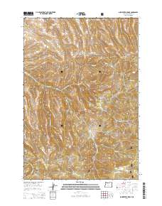
2014 Map of Summerfield Ridge
USGS Topo · Published 2014About this map
The Umatilla National Forest anchors the southern half of this Oregon landscape, where the high-altitude terrain is carved by a dense network of water sources and canyons. Named springs, including Sperry Spring, Smith Birch Spring, and Skinner Spring, are vital landmarks in this arid environment, serving as the headwaters for seasonal and perennial flows like Balm Fork and Skinner Fork. The topography is dominated by the prominent Summerfield Ridge and deeply incised features such as Summerfield Canyon and Carmichael Canyon. This 2014 survey reveals a landscape largely shaped by its hydrology, with Rhea Cr and Caplinger Cr tracing the low-lying drainages. Access to this territory is provided by rugged paths like Lunceford Canyon Rd and various Forest Service routes, reflecting the area's primary use for timber management and backcountry recreation within the national forest system.
Find a feature on this map
36 named features on this map. Tap any name to fly to it.
Don’t see what you’re looking for? This feature index may not catch every label — zoom into the map to look around manually.
Map Details
Editions of this 2014 Summerfield Ridge Map
This is the sole edition of this map. No revisions or reprints were ever made.
Other maps of this area

1953 · Pendleton
USGS Topo · 1:250,000

1956 · Pendleton
USGS Topo · 1:250,000

1967 · Freezeout Ridge
USGS Topo · 1:24,000

1968 · Heppner
USGS Topo · 1:24,000

1968 · Skinners Fork
USGS Topo · 1:24,000

1969 · Summerfield Ridge
USGS Topo · 1:24,000

1969 · Lake Penland
USGS Topo · 1:24,000

1969 · Arbuckle Mtn
USGS Topo · 1:24,000

1969 · Madison Butte
USGS Topo · 1:24,000

1969 · Big Rock Flat
USGS Topo · 1:24,000