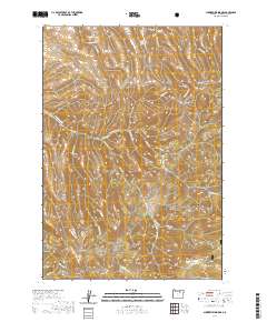
2020 Map of Summerfield Ridge
USGS Topo · Published 2020About this map
Umatilla National Forest defines the southern reach of this landscape, where the Copple Butte Trail winds through the high terrain above Rutabaga Creek. The topography is dominated by a series of dramatic drainages and ridges, most notably Summerfield Ridge and its namesake Summerfield Canyon. To the north, the land is etched by a network of steep-walled features including Sanford Canyon, Gilman Canyon, and Carmichael Canyon.
Find a feature on this map
36 named features on this map. Tap any name to fly to it.
Don’t see what you’re looking for? This feature index may not catch every label — zoom into the map to look around manually.
Map Details
Editions of this 2020 Summerfield Ridge Map
This is the sole edition of this map. No revisions or reprints were ever made.
Other maps of this area

1953 · Pendleton
USGS Topo · 1:250,000

1956 · Pendleton
USGS Topo · 1:250,000

1967 · Freezeout Ridge
USGS Topo · 1:24,000

1968 · Heppner
USGS Topo · 1:24,000

1968 · Skinners Fork
USGS Topo · 1:24,000

1969 · Summerfield Ridge
USGS Topo · 1:24,000

1969 · Lake Penland
USGS Topo · 1:24,000

1969 · Arbuckle Mtn
USGS Topo · 1:24,000

1969 · Madison Butte
USGS Topo · 1:24,000

1969 · Big Rock Flat
USGS Topo · 1:24,000