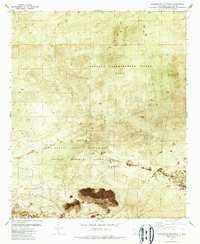
1982 Map of Summerford Mountain
USGS Topo · Published 1987About this map
Jornada Experimental Range (U S D A) occupies the northern expanse of this 1980s orthophotomosaic, a landscape dedicated to agricultural research in the Chihuahuan Desert. The map utilizes a photographic base, revealing the sparse vegetation and drainage patterns of the arid terrain, including the meandering Lucero Arroyo in the south. The dominant topographical features are the Dona Ana Mountains, anchored by the distinctive peak of Summerford Mountain.
Find a feature on this map
13 named features on this map. Tap any name to fly to it.
Don’t see what you’re looking for? This feature index may not catch every label — zoom into the map to look around manually.
Map Details
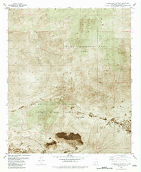
Editions of this 1982 Summerford Mountain Map
2 editions found
Other maps of this area

1891 · Las Cruces
USGS Topo · 1:125,000

1893 · Las Cruces
USGS Topo · 1:125,000

1916 · Tonuco
USGS Topo · 1:125,000

1932 · Tonuco
USGS Topo · 1:125,000

1941 · Las Cruces
USGS Topo · 1:62,500

1941 · Organ Peak
USGS Topo · 1:62,500

1943 · Organ Peak
USGS Topo · 1:62,500

1943 · Las Cruces
USGS Topo · 1:62,500

1948 · Bear Peak
USGS Topo · 1:62,500

1948 · San Diego Mountain
USGS Topo · 1:62,500