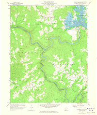
1969 Map of Summersville Dam
USGS Topo · Published 1973About this map
The confluence of the Gauley River and Meadow River serves as the focal point for this survey, dominated by the recently created Summersville Lake. The landscape reflects a shift from traditional river-valley settlement to managed recreation, with Summersville Dam controlling the waters that once dictated travel. Nearby, the preservation of the Old Carnifex Ferry Site within the Carnifex Ferry Battlefield State Park marks a significant historical crossing point and Civil War site.
Find a feature on this map
56 named features on this map. Tap any name to fly to it.
Don’t see what you’re looking for? This feature index may not catch every label — zoom into the map to look around manually.
Map Details
Editions of this 1969 Summersville Dam Map
3 editions found
Other maps of this area

1889 · Nicholas
USGS Topo · 1:125,000

1891 · Nicholas
USGS Topo · 1:125,000

1897 · Kanawha Falls
USGS Topo · 1:125,000

1900 · Kanawha Falls
USGS Topo · 1:125,000

1901 · Nicholas
USGS Topo · 1:125,000

1901 · Kanawha Falls
USGS Topo · 1:125,000

1908 · Clay
USGS Topo · 1:48,000

1908 · Fayetteville
USGS Topo · 1:48,000

1910 · Clay
USGS Topo · 1:62,500

1910 · Fayetteville
USGS Topo · 1:62,500