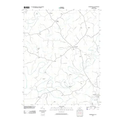
2010 Map of Summersville
USGS Topo · Published 2010About this map
The Narrows of Pitman defines a dramatic bend in Big Pitman Creek, reflecting the intricate drainage patterns of this Green County landscape. This 2010 survey highlights a region densely populated with family burial grounds, including the DeWitt Cemetery, Chaudoin Cemetery, and Akin Cemetery, which provide significant touchstones for genealogical research. The map captures the small settlements of Summersville, Gabe, and Webbs, along with the northern outskirts of Greensburg. Geologic interest is found at The Sinks of Little Brush and the Blue Hole, while industrial remnants like an Oil Well Hole appear near the Green River. The extensive rural road network, featuring names like Hennein Berry Rd and Bales Milby Rd, connects these remote hamlets and points of interest across the undulating terrain.
Find a feature on this map
80 named features on this map. Tap any name to fly to it.
Don’t see what you’re looking for? This feature index may not catch every label — zoom into the map to look around manually.
Map Details
Editions of this 2010 Summersville Map
This is the sole edition of this map. No revisions or reprints were ever made.
Other maps of this area

1953 · Saloma
USGS Topo · 1:24,000

1953 · Hudgins
USGS Topo · 1:24,000

1953 · Hibernia
USGS Topo · 1:24,000

1953 · Summersville
USGS Topo · 1:24,000

1953 · Exie
USGS Topo · 1:24,000

1953 · Magnolia
USGS Topo · 1:24,000

1953 · Gresham
USGS Topo · 1:24,000

1953 · Center
USGS Topo · 1:24,000

1954 · Greensburg
USGS Topo · 1:24,000

1957 · Winchester
USGS Topo · 1:250,000