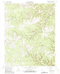
1968 Map of Summersville NE
USGS Topo · Published 1983About this map
Spring Valley and the surrounding karst topography of Shannon County define this landscape as it appeared in the late 1960s. The topography is marked by significant geologic features like the Forty Acre Sinkhole and numerous hollows such as Standing Rock Hollow and Kingfisher Hollow. These drainages feed into larger systems like Black Valley Creek and Bay Creek, illustrating the complex watershed of the eastern Ozarks. Portions of the map are protected under the Ozark National Scenic Riverways, a boundary established just a few years prior to this field check.
Find a feature on this map
21 named features on this map. Tap any name to fly to it.
Don’t see what you’re looking for? This feature index may not catch every label — zoom into the map to look around manually.
Map Details
Editions of this 1968 Summersville NE Map
3 editions found
Other maps of this area

1915 · Eminence
USGS Topo · 1:62,500

1917 · Eminence
USGS Topo · 1:62,500

1932 · Cedar Grove
USGS Topo · 1:48,000

1945 · Round Spring
USGS Topo · 1:62,500

1946 · Summersville
USGS Topo · 1:62,500

1947 · Sinkin
USGS Topo · 1:48,000

1948 · Summersville
USGS Topo · 1:62,500

1949 · Round Spring
USGS Topo · 1:62,500

1949 · Rolla
USGS Topo · 1:250,000
1951 · Lewis Hollow
USGS Topo · 1:24,000